
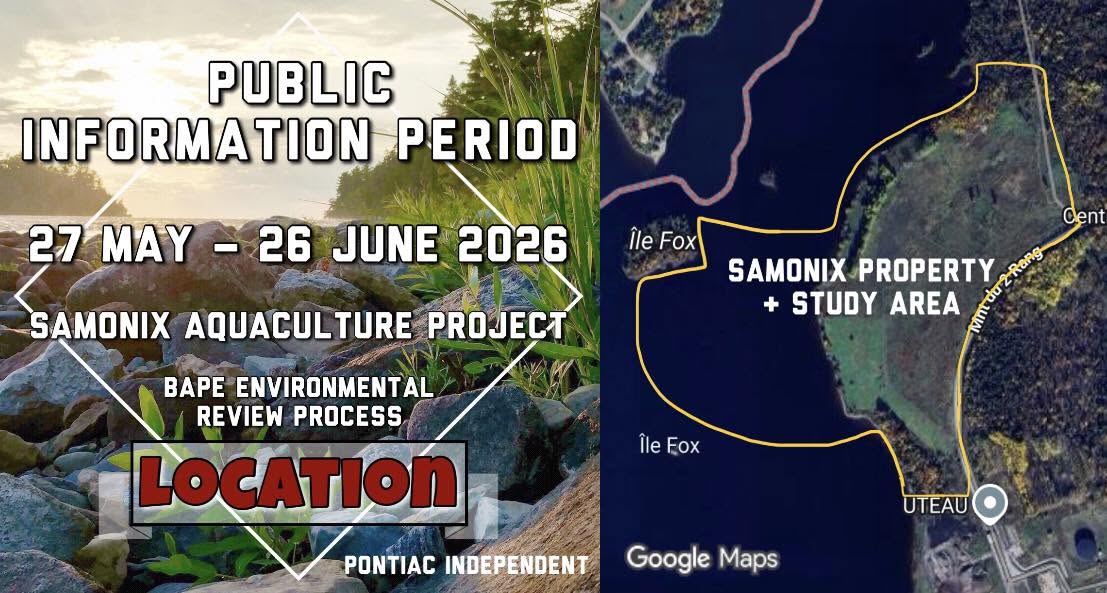
As the BAPE process continues, many Pontiac residents are seeking a clearer understanding of the site’s geography, industrial history, and surrounding waterways.
The proposed development site is located along the banks of the Ottawa River within the Pontiac Regional Industrial Park in Litchfield, the largest privately owned park in the greater Ottawa area, spanning 1,800 acres.
The Samonix property spans approximately 495,000 square metres and is situated between Grand Calumet Island and the Chenaux hydroelectric generating station.
The site is located roughly four kilometres from Bryson and approximately five kilometres upstream from Portage-du-Fort. The nearest residence is located about two kilometres east of the proposed development area, while cottage properties across the river on the Île-du-Grand-Calumet peninsula sit roughly 500 metres from the future facilities.
The surrounding area also includes municipal infrastructure directly connected to the Ottawa River system. South of the study area is the Litchfield wastewater treatment facility, while the Portage-du-Fort municipal water intake is located approximately five kilometres downstream.
In addition to the river, a smaller tributary watercourse was identified within the southern portion of the study area, forming part of the broader aquatic environment surrounding the proposed project site.
The site itself has a long industrial history. Prior to the 1960s, the land was primarily used for agriculture before being assembled into a larger industrial property to support the construction of the former Smurfit-Stone pulp and paper mill.
From the mid-1960s until the mill’s closure in 2010, the property largely functioned as a log storage and lumber handling yard connected to nearby paper production operations. Following the closure of the mill, the broader property changed ownership several times before eventually being subdivided and later acquired by Gestion Samonix in 2022.
Since then, the land has remained inactive while the proposed aquaculture project proceeds through planning and regulatory stages.
Project documents indicate that no flood zones are currently mapped within the study area, however a portion at the southern end of the property was included within Québec’s 2019 special intervention zone established following the spring flooding events of 2017 and 2019. The MRC’s floodplain mapping also remains incomplete and therefore the site is not currently listed in the region's flood zone.
While the neighbouring municipality of Bryson contains several recognized heritage sites, a 2025 study by Archéotec Inc., only identified one archaeological site within a five-kilometre radius of the study area.
River corridors such as the Ottawa River are generally recognized as areas with elevated archaeological potential due to centuries of Indigenous travel, seasonal use, settlement, and trade activity along the waterway. While the documentation does not acknowledge the historical or cultural significance of the Kichi Sibi, it does describe the Ottawa River as a scenic corridor of regional interest.
As public consultation continues through the BAPE process, understanding where the site is located and its history may help residents better evaluate both the opportunities and concerns associated with the proposed project.